
|
1940 Census for Lower Gwynedd PA
|
|
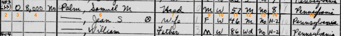
| 2 | Number recorded by census person | 10 | Race of household member |
| 4 | Cost of house or rent amount / O or R in column 3 | 11 | Age of household member |
| 6 | Names of house occupants | 12 | Marital status of household member |
| 7 | Relationship to head of household | 13 | Attending school? |
| 9 | Gender of household member | 14 | Years of school completed |
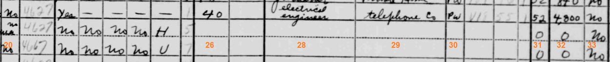
| 20 | Residence on a farm or not ? | 30 | Class of worker |
| 26 | Hours worked per week | 31 | Weeks worked in 1939 |
| 28 | Occupation | 32 | Annual income in 1939 |
| 29 | Industry | 33 | Any income of $50+ other than wages? |
| ©2002 Sales and People | Top |