EXCERPTS FROM DEED
Beginning at a
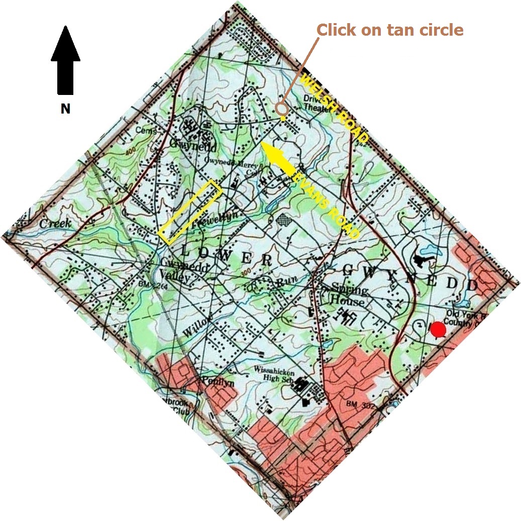
point .(southern most point of drawing below). . on . . Meeting House Road . . also on Evans Road (see yellow dot in above map)
Three hundred and five feet in a Northeasterly direction toward Welsh Road
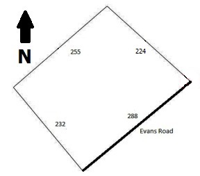
ACTUAL PLOT MEASUREMENTS IN DEED
South fifty degrees twenty three minutes West two hundred and eighty eight feet
North thirty nine degrees thirty seven minutes West two hundred twenty four feet
North forty nine degrees eight minutes East two hundred fifty five feet
South forty seven degrees nine minutes East two hundred thirty two feet to the beginning point
MEASUREMENTS PROVIDE FOLLOWING PLOT DIAGRAM
George and Marie Price sold the parcel to Samuel and Jean Palm on June 15, 1939