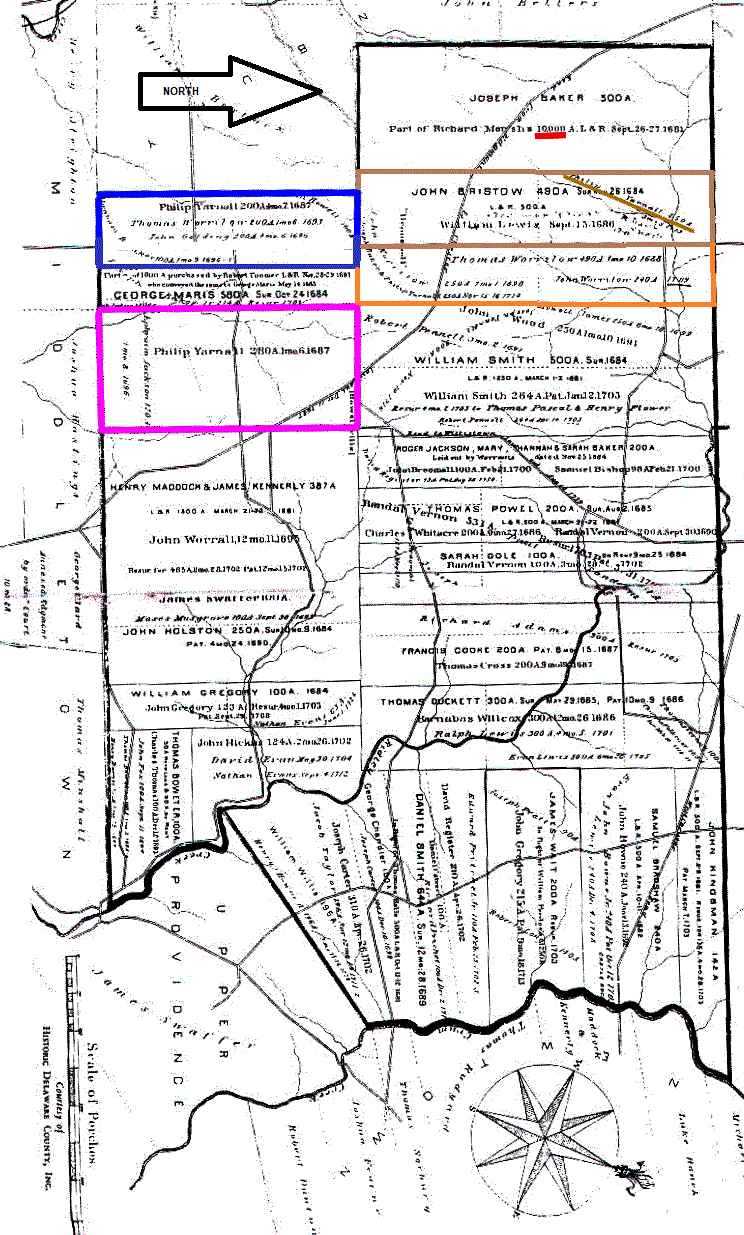
In 1681 all of Edgmont was only 7,000 acres, so the notation has to be wrong.
The January 6, 1687 purchase of 280 acres from George Maris by Philip Yarnall is outlined in lavender on the map with a notation of "280A1mo.6.1687". Pause your cursor on this parcel of land.
The April 7, 1687 purchase of 200 acres from Thomas Worrilow by Philip Yarnall is outlined in blue on the map with a notation of "200A4mo.7.1687". The notation is very difficult to read.
The 150 acre purchase by Philip Yarnall from John Bristow and/or William Lewis in 1694 is outlined in tan. That was the same year Philip married Dorothy Baker. This was part of the original Richard Marsh land.
He may have purchased the parcel outlined in orange also. There was a notation for 1714 about a purchase from Thomas Worrilow's son John.
Philip became a significant landowner in Chester County because he also owned land in Ridley Township. He left his land to his heirs in his 1733 will.
Below this map you can click "Next" to view a map showing the 1848 Edgmont landowners.
