 |
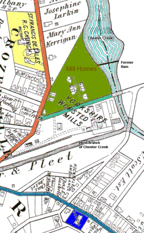
This zoomview of the Crozerville area shows Yorkshire
Mills was at the confluence of two creeks. Chester Creek (the wide
one with light blue streaks) and the West Branch of Chester
Creek (the narrow one). This is the site of the original Crozerville
Mill.
Hollow Hill Road (colored blue-green) ran between the mill buildings
and the the mill homes (area is colored pea-green). Hollow Hill Road crossed over
Chester Creek at the Hollow Hill Bridge. Hollow Hill Road was the address
for the Grant Yarnall family in the late 1800s and early 1900s. That road no longer exists.
William H. Yarnall, Jr (Grant's brother) married the Kerrigan girl. You can see the Kerrigan
property that was adjacent to the area where the mill homes were.
New Road is colored reddish-tan. St Francis de Sales Church (yellow area) was built on New
Road in 1894.
Mount Road (colored blue) is where the new public school was
built in 1916 on a site colored royal blue. You
may need to scroll down to see it. |