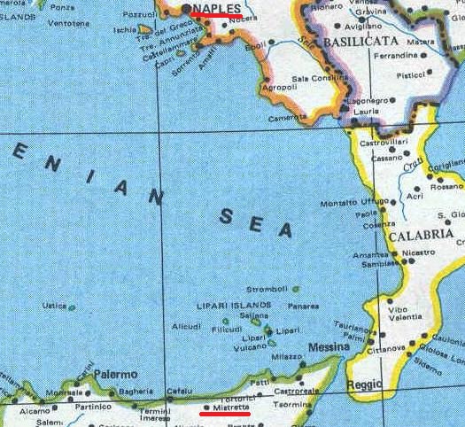
| An overland trip to Naples
was about 400 miles. That is about the same distance as a trip from Cherry Hill, NJ to Raleigh, NC. They did not have a highway system back then like we have now in the USA. If Vincenzo and Salvatore traveled by land they would have first gone east across the province of Messina to get to the Strait of Messina, go across the strait, travel north up the Calabria Region, travel across the Basilicata Region, and finally travel across part of the Campania Region to get to Naples. I have no idea how long that took, but it probably took almost a month to cross the Atlantic by ship in 1900 for Salvatore and in 1903 for Vincenzo. A trip to Naples by boat was about 200 miles across the Tyrrhenian Sea from ports in Sicily. A small port, Santo Stefano di Camastra, is about 12 miles from Mistretta. People could board a small fishing boat to cross the Tyrrhenian. Pause your cursor on the dot depicting the town named Mistretta. |
|