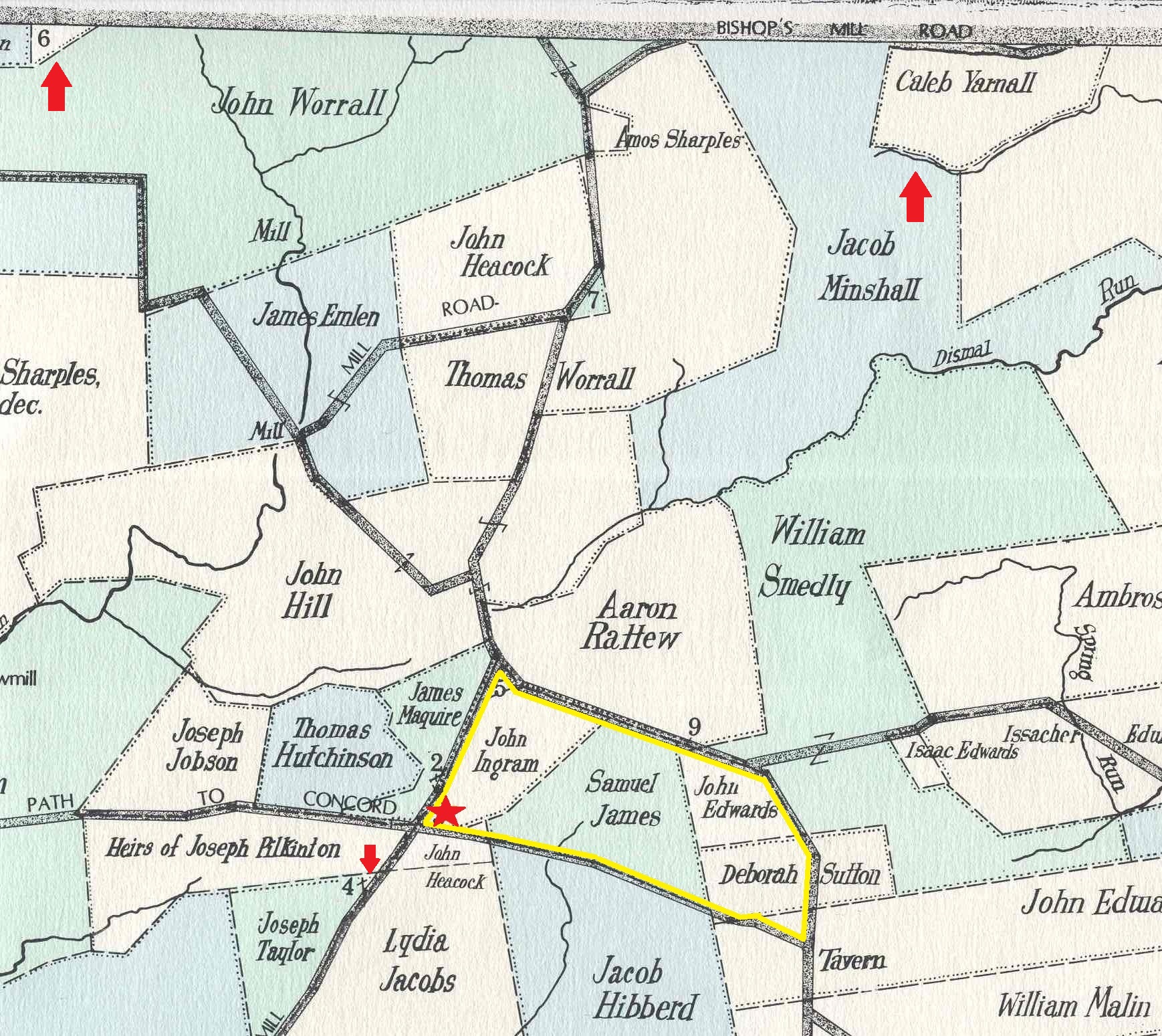
This area was known as Wrangletown because of activities at a tavern built on the property where the red star is.
Joe Yarnall had a small piece of property just down the road from the tavern - find number "4" (one of the red arrows points to it). He apparently was a frequent patron at the tavern. On the 1799 Middletown tax list it indicates his occupation was a wheelwright - one who worked on wooden wheels.
Number "6" marks the property of Eli Yarnall that was primarily in Edgmont. (See top left red arrow)
The Caleb Yarnall property was owned by a man in our branch of the family tree. (See top right red arrow)
The road on which Joe's property is located was called Road to Pennell's Mill, later known as Rockdale Road, and now is known as Pennell Road (Route 452).
The road marked "Path to Concord" now is known as Baltimore Pike (Route 1).